


PRECINCT JACKSON-A, Montgomery County, Ohio
About
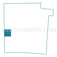
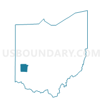
Outline

Summary
| Unique Area Identifier | 650461 |
| Name | PRECINCT JACKSON-A |
| County | Montgomery County |
| State | Ohio |
| Area (square miles) | 9.68 |
| Land Area (square miles) | 9.68 |
| Water Area (square miles) | 0.00 |
| % of Land Area | 100.00 |
| % of Water Area | 0.00 |
| Latitude of the Internal Point | 39.72220800 |
| Longtitude of the Internal Point | -84.45262730 |
Maps

Graphs
Select a template below for downloading or customizing gragh for PRECINCT JACKSON-A, Montgomery County, Ohio


Neighbors
Neighoring Voting District (by Name) Neighboring Voting District on the Map
- PRECINCT JACK/NEW LEBANON-A, Montgomery County, OH
- PRECINCT JACKSON-B, Montgomery County, OH
- PRECINCT JACKSON-C, Montgomery County, OH
- PRECINCT LANIER EAST, Preble County, OH
- PRECINCT LANIER SOUTH, Preble County, OH
- PRECINCT PERRY-C, Montgomery County, OH
- PRECINCT TWIN EAST, Preble County, OH
Top 10 Neighboring County Subdivision (by Population) Neighboring County Subdivision on the Map
- Jackson township, Montgomery County, OH (6,335)
- Perry township, Montgomery County, OH (5,999)
- Lanier township, Preble County, OH (3,853)
- Twin township, Preble County, OH (2,790)
Top 10 Neighboring Place (by Population) Neighboring Place on the Map
Top 10 Neighboring Unified School District (by Population) Neighboring Unified School District on the Map
- Valley View Local School District, OH (10,658)
- New Lebanon Local School District, OH (7,006)
- Twin Valley Community Local School District, OH (5,688)
Top 10 Neighboring State Legislative District Lower Chamber (by Population) Neighboring State Legislative District Lower Chamber on the Map
Top 10 Neighboring State Legislative District Upper Chamber (by Population) Neighboring State Legislative District Upper Chamber on the Map
Top 10 Neighboring 111th Congressional District (by Population) Neighboring 111th Congressional District on the Map
Top 10 Neighboring Census Tract (by Population) Neighboring Census Tract on the Map
- Census Tract 1501, Montgomery County, OH (6,335)
- Census Tract 1401, Montgomery County, OH (5,999)
- Census Tract 4401, Preble County, OH (3,859)
- Census Tract 4301, Preble County, OH (2,790)